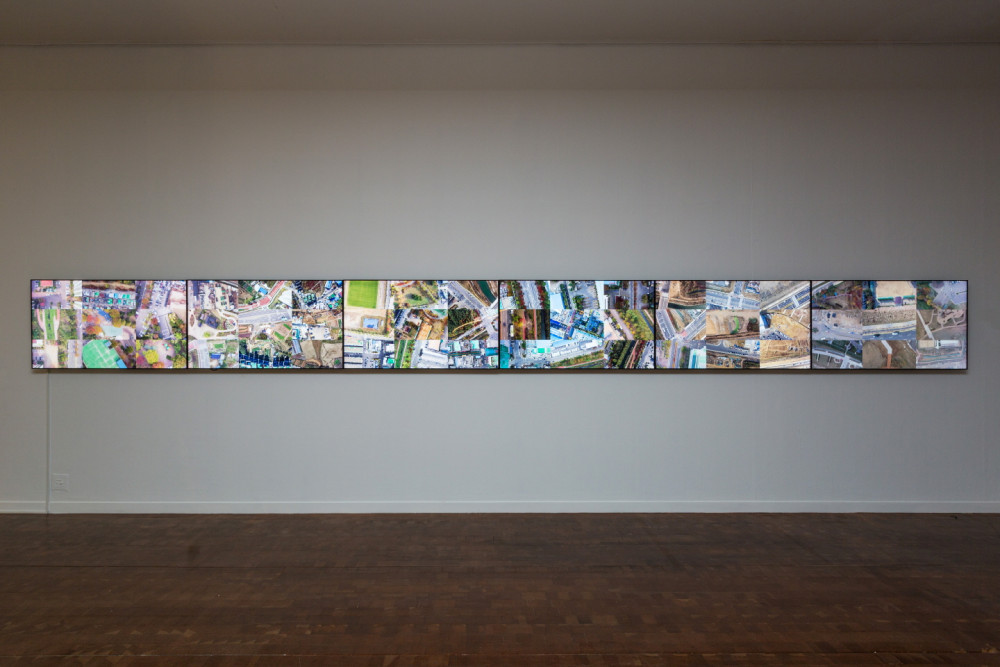
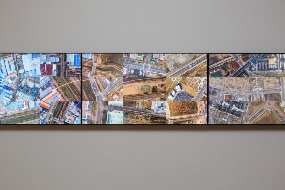

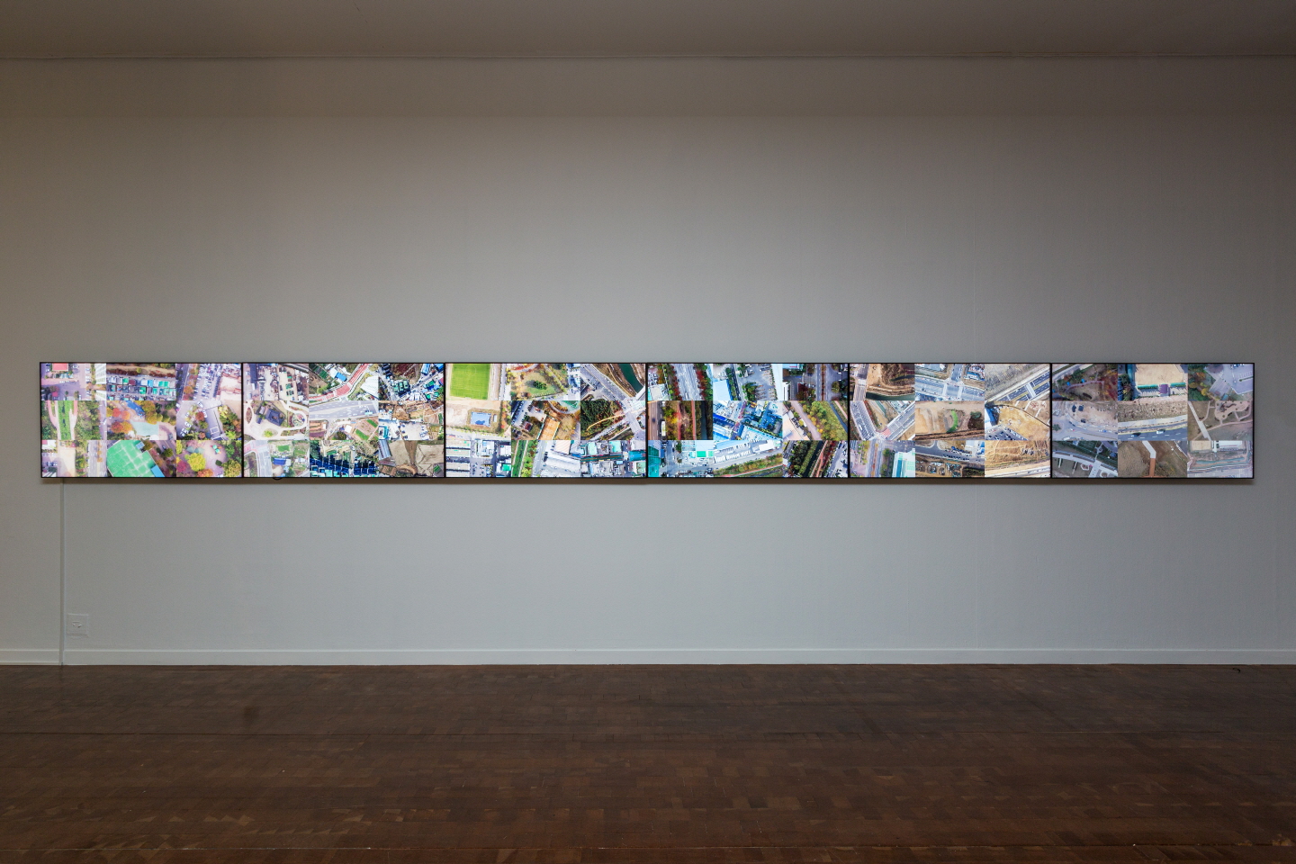
Today, people sense and understand places through what is viewed on a flat monitor screen. FLATCITY Project_Flat54 captures the way in which people recognize our landscape through online map service programs (e.g. Google Earth), and attempts to transfer the virtual experience of place into the physical world through drone footage. To find out our current location or other places, we, located between the two dimensions of online-offline, use online map services, get information on places, and constitute our sense of the earth as a real place. Such phenomena raise a fundamental question on human identity/subjectivity, located in between virtual and real worlds: where am I located now? Just like the way we zoom in and out on a computer screen, FLATCITY Project_Flat54, shot by drone, vertically zooms in and out of the real earth. In this process, the real city structure that holds real physical and material movements is followed by fragmented screen frames. The work demonstrates that maps or location tracking systems restructure our daily city space, and ultimately reveals the flattened cityscape rendered by these systems.